Datça peninsula, Hisarönü Gulf and Bozburun
The map opens as you scroll to it
Knidos at the tip, Bozburun's gulet yards and the quiet coves of the Hisarönü Gulf.
JFMAMJJASOND
The region
The Datça peninsula reaches almost to the Greek islands of Kos and Symi. Datça town has a harbour and marina, Palamutbükü a long bay on the south side, and at the very tip lies Knidos, an ancient city with two harbours that boats still use.
To the east, the Hisarönü Gulf and the Bozburun peninsula hold dozens of coves: Selimiye, Bozburun, Söğüt, Orhaniye with its sandbar, Keçibükü and Dirsekbükü. Bozburun is also where many wooden gulets are built and repaired.
Winds and season
The meltem is strong around Cape Krio at the tip of the peninsula, where wind and sea build quickly; round it early in the day. Inside the Hisarönü Gulf the wind is lighter and the coves are calm. Spring and autumn are excellent here.
The region in numbers
Counted from the records on Boat Almanac, November 2026. A number missing or wrong? Correct it on the place's page, and it helps the next crew planning here.
Shelter by wind
Where boats in this region find shelter when the wind blows from each direction. From the route data and sailors' reports; check the forecast and your chart, as swell can wrap round headlands.
| Wind from | Sheltered |
|---|---|
| N | Bozukkale, Keçi Bükü (Orhaniye), Serçe Limanı |
| NE | Bozukkale, Dirsek Bükü, Keçi Bükü (Orhaniye), Serçe Limanı |
| E | Bozukkale, Dirsek Bükü, Keçi Bükü (Orhaniye), Serçe Limanı |
| SE | Dirsek Bükü, Keçi Bükü (Orhaniye), Serçe Limanı |
| S | Dirsek Bükü, Keçi Bükü (Orhaniye), Serçe Limanı |
| SW | Bozukkale, Dirsek Bükü, Keçi Bükü (Orhaniye), Serçe Limanı |
| W | Bozukkale, Dirsek Bükü, Keçi Bükü (Orhaniye), Serçe Limanı |
| NW | Bozukkale, Dirsek Bükü, Keçi Bükü (Orhaniye), Serçe Limanı |
Getting there
- Rhodes International Airport "Diagoras" (RHO), Rhodes about 45 km from the middle of the region
- Kos International Airport "Ippokratis" (KGS), Kos Island about 60 km from the middle of the region
- Milas Bodrum (BJV), Bodrum about 61 km from the middle of the region
Straight-line distance; by road it is usually a third longer. Each marina page gives its own nearest airports.
Legs along the coast
| To | About | At 6 knots |
|---|---|---|
| Gökova Gulf | 25 NM | 5 h, a day sail |
| Marmaris | 35 NM | 7 h, a day sail |
Middle of one region to the middle of the next, with a quarter added for the coast and the wind. Plan the real legs in the route planner.
Want company on these waters? Find a buddy boat or crew on Sail together.
Where to stop
- Knidos
Ancient harbour at the tip; exposed when the wind turns south. - Palamutbükü
Long south-side bay with a small harbour and restaurants. - Selimiye
Village bay with restaurants and jetties. - Bozburun
Gulet-building village with a small harbour. - Orhaniye and Keçibükü
Sheltered bay with a marina and the Kız Kumu sandbar. - Dirsekbükü
Quiet cove in the inner gulf. - Kuruca Bükü
Sheltered bay north of the Datça peninsula's centre. - Hayıtbükü
Small village bay near Palamutbükü with restaurants. - Söğüt (Bozburun)
Village bay facing Symi, quieter than Bozburun town. - Bençik
Narrow fjord-like bay almost cutting the Datça peninsula in two.
Harbours and anchorages on the route planner
| Place | Type | Fuel | Water | Pump-out | Shelter |
|---|---|---|---|---|---|
| Bozburun | Harbour | ||||
| Datça harbour | Harbour | ||||
| Selimiye | Harbour | ||||
| Bencik Liman | Anchorage | ||||
| Bozukkale | Anchorage | sheltered from N, NE, E, SW, W, NW | |||
| Dirsek Bükü | Anchorage | sheltered from NE, E, SE, S, SW, W, NW | |||
| Keçi Bükü (Orhaniye) | Anchorage | sheltered all round | |||
| Knidos | Anchorage | ||||
| Serçe Limanı | Anchorage | sheltered all round |
Positions are approximate. Plan a passage between any two of them in the route planner.
Been here? Rate a cove in a few taps and the next skipper will thank you.
Anchoring and mooring
The Hisarönü gulf and the Bozburun peninsula have dozens of coves with sand and weed bottoms, often deep close to the shore. Lines ashore are normal, and many coves have rings or rocks to tie to. Restaurants at Selimiye, Bozburun and several bays have jetties, sometimes with laid moorings. Knidos is open to the west and can roll in a big swell, while Palamutbükü is a small harbour with limited room. In a strong north-west wind, the inner coves of Hisarönü and Orhaniye give good shelter.
A one-week route
A realistic loop for a week, with short days you can stretch or cut to the weather. Check every leg on the chart and the route planner.
- Marmaris or Orhaniye to Keçibükü, about 15 NM. Sheltered bay and the sandbar walk to the islet.
- Keçibükü to Selimiye, about 6 NM. Village quay and good restaurants.
- Selimiye to Bozburun, about 6 NM. Gulet building town, supplies.
- Bozburun to Dirsekbükü, about 15 NM. A quiet anchorage on the way west.
- Dirsekbükü to Datça, about 15 NM. Town harbour and almond trees.
- Datça to Knidos, about 15 NM round the end of the peninsula. Visit the ancient city.
- Knidos to Palamutbükü and back towards Datça, about 10 NM, ready for the leg home.
Rules and protected areas
Clearing in: Datça is a frontier port, convenient from Kos or Symi. Step by step in Arriving by boat in Turkey.
Fuel, water, repairs and supplies
Datça has a marina, fuel and good shopping. Keçibükü has a marina with lift-out and winter storage; Bozburun's yards specialise in wooden boats. For bigger repairs, Marmaris is close.
Marinas
All marinas in Turkey → Marmaris
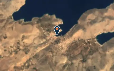 MarinaGialosRhodes Regional Unit Restaurant MarinaKairos MarinaDatcaKairos Marina is a marina in Turkey. MarinaPalamut MarinaDatcaPalamut Marina is a marina in Turkey. MarinaSelimiyeBozburunSelimiye is a marina in Turkey.
 Rhodes Regional Unit
Boatyards and haul-out
All boatyards in Turkey →Boat services
All boat services →Wind here, next 7 days
The forecast loads as you scroll.
Hour by hour, waves and sunset → · Data: MET Norway (CC BY 4.0). Always check the official marine forecast before you leave.
Questions about Datça peninsula, Hisarönü Gulf and Bozburun
Is Knidos a safe overnight stop?
In settled weather it is magical, but the bay is open to the west and the wind can funnel round the cape at night. Watch the forecast and be ready to move.
Where can I provision?
Datça and Bozburun have supermarkets, bakeries and markets; Selimiye has small shops. Fuel is available at Datça and by tanker or small stations in some villages.
Do I need to worry about crossing to Symi?
Symi is Greek. You must clear out of Turkey and into Greece formally before visiting; casual hops across are not allowed.
Cruising nearby
Written by the Boat Almanac editors from charts, official notices and boaters' reports; lists are updated from the almanac every day. Something changed? Suggest a correction.