Göcek, Fethiye and the Skopea islands
The map opens as you scroll to it
Twelve islands, sheltered coves with stern lines ashore, and new buoy zones since 2026.
JFMAMJJASOND
The region
The Göcek gulf, with its twelve islands, is the most sheltered cruising ground in Turkey. The coves are close together, the water is calm and most nights are spent with an anchor out and a stern line tied to a pine tree. Göcek village has several marinas and Dalaman airport is twenty minutes away.
Fethiye, at the south end of the bay, is a town with a marina and a big Tuesday market. Beyond it lie Gemiler Island with its Byzantine ruins and the Ölüdeniz coast. To the west, Ekincik is the starting point for river boats up to Dalyan and Kaunos.
Winds and season
The bay is sheltered in almost any summer wind; the afternoon breeze comes from the west and rarely makes the coves uncomfortable. Outside, along the coast towards Ekincik or Kaş, the meltem can be strong. The season runs from April to November.
The region in numbers
Counted from the records on Boat Almanac, November 2026. A number missing or wrong? Correct it on the place's page, and it helps the next crew planning here.
Shelter by wind
Where boats in this region find shelter when the wind blows from each direction. From the route data and sailors' reports; check the forecast and your chart, as swell can wrap round headlands.
| Wind from | Sheltered |
|---|---|
| N | Baba Adası, Ekincik – Maden İskelesi Bay, Göcek bays, Tersane Island cove |
| NE | Baba Adası, Ekincik – Maden İskelesi Bay, Göcek bays, Tersane Island cove |
| E | Ekincik – Maden İskelesi Bay, Göcek bays, Tersane Island cove |
| SE | Ekincik – Maden İskelesi Bay, Göcek bays, Tersane Island cove |
| S | Göcek bays, Tersane Island cove |
| SW | Ekincik – Maden İskelesi Bay, Göcek bays, Tersane Island cove |
| W | Ekincik – Maden İskelesi Bay, Göcek bays, Tersane Island cove |
| NW | Baba Adası, Ekincik – Maden İskelesi Bay, Göcek bays, Tersane Island cove |
Getting there
- Dalaman (DLM), Dalaman about 12 km from the middle of the region
- Rhodes International Airport "Diagoras" (RHO), Rhodes about 78 km from the middle of the region
- Milas Bodrum (BJV), Bodrum about 128 km from the middle of the region
Straight-line distance; by road it is usually a third longer. Each marina page gives its own nearest airports.
Legs along the coast
| To | About | At 6 knots |
|---|---|---|
| Marmaris | 35 NM | 6 h, a day sail |
| Kalkan, Kaş and Kekova | 65 NM | 2 days of about 8 h |
Middle of one region to the middle of the next, with a quarter added for the coast and the wind. Plan the real legs in the route planner.
Want company on these waters? Find a buddy boat or crew on Sail together.
Where to stop
- Yassıca Islands
Shallow turquoise water between low islands; inside a buoy zone. - Sarsala (Büyük and Küçük)
Deep coves with restaurant jetties; buoy zone. - Boynuzbükü
Long sheltered cove with a restaurant; buoy zone. - Bedri Rahmi
Cove named after the painter's rock fish; buoy zone. - Kapı Creek and Tersane
Quieter coves on the islands. - Gemiler Island
Byzantine ruins; stern-to along the channel. - Kille bay
Inner Göcek bay now in the buoy system, sheltered and green. - Martı bay
Calm bay near the Göcek channel, part of the buoyed zone. - Ölüdeniz approach
The famous lagoon itself is closed to boats, but the coast off Belcekız has swim stops in calm weather. - Kızılada
Island with a lighthouse at the entrance to the Fethiye gulf.
Harbours and anchorages on the route planner
| Place | Type | Fuel | Water | Pump-out | Shelter |
|---|---|---|---|---|---|
| Fethiye | Marina | Fuel dock | Yes | Yes | |
| Göcek | Marina | Fuel dock | Yes | Yes | |
| Baba Adası | Anchorage | sheltered from N, NE, NW; open to SE, S, SW | |||
| Ekincik | Anchorage | ||||
| Ekincik – Maden İskelesi Bay | Anchorage | sheltered from N, NE, E, SE, SW, W, NW; open to S | |||
| Göcek bays | Anchorage | sheltered all round | |||
| Kızılkuyruk Koyu | Anchorage | ||||
| Tersane Island cove | Anchorage | sheltered all round | |||
| Tomb Bay (Taşyaka / Bedri Rahmi) | Anchorage |
Positions are approximate. Plan a passage between any two of them in the route planner.
Been here? Rate a cove in a few taps and the next skipper will thank you.
Anchoring and mooring
Göcek has changed: from the 2026 season, paid mooring buoys run by the authorities have replaced anchoring in several of the most popular bays, including the Yassıca islands, the Sarsala bays, Boynuzbükü, Kille, Bedri Rahmi and Martı. Buoys are booked online in advance and support boats help you on. Outside the buoyed zones you can still anchor, usually with a line ashore, in sand and mud with good holding. The Fethiye-Göcek area is a special environmental protection area: no discharge of any waste water, and be ready to show your Blue Card records. Restaurant jetties are common and popular.
A one-week route
A realistic loop for a week, with short days you can stretch or cut to the weather. Check every leg on the chart and the route planner.
- Göcek to the Yassıca islands, about 5 NM. Swim stop; book a buoy or move on.
- Yassıca to Sarsala, about 6 NM. Pine-backed bays, buoys in the main zones.
- Sarsala to Boynuzbükü or Kille, about 5 NM. Quiet water, restaurant jetties nearby.
- Göcek gulf to Tersane and Kapı Creek, about 8 NM. Ruins and a tight, sheltered creek.
- Kapı Creek to Fethiye, about 15 NM. Town, market and fuel.
- Fethiye to Gemiler Island, about 12 NM. Byzantine ruins; anchor off or go on a buoy.
- Gemiler back to Göcek, about 20 NM. Afternoon wind on the beam.
Rules and protected areas
Clearing in: Fethiye is a frontier port. Göcek boats usually clear in or out at Fethiye. Step by step in Arriving by boat in Turkey.
Fuel, water, repairs and supplies
Göcek's marinas have fuel, water, lift-out and service firms; Fethiye's marina and yards handle repairs and winter storage. Restaurants with jetties often sell water and bread. Dalaman airport makes crew changes easy.
Marinas
All marinas in Turkey → Göcek
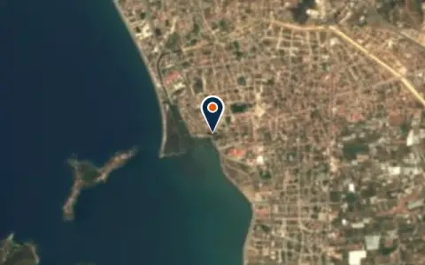 MarinaEce Saray MarinaFethiye 460 berths Boats up to 60 m VHF 16Fethiye's main marina with port-of-entry facilities. Gateway to the Turkish turquoise coast and the start of the classic… MarinaKapi Creek private marinaGoecekKapi Creek private marina is a marina in Turkey. MarinaMai Sun CityFethiyeMai Sun City is a marina in Fethiye, Turkey. MarinaMunicipality MarinaGöcekMunicipality Marina is a marina in Göcek, Turkey. MarinaMy Marina Yacht ClubDalyanMy Marina Yacht Club is a marina in Turkey. MarinaSkopea Marina GöcekGöcek 330 berths Boats up to 60 m VHF 16 / 73One of four marinas in the sheltered Gulf of Göcek, a port of entry set within one… MarinaYes MarinaFethiyeYes Marina is a marina in Turkey.
Boatyards and haul-out
All boatyards in Turkey → BoatyardFethiye BoatyardFethiye 60 t lift Boats up to 22 m VHF 16Fethiye Boatyard provides haul-out and antifouling services for the popular Fethiye bay cruising ground, with a 60-tonne lift…
 BoatyardGöcek ShipyardGöcek 50 t lift Boats up to 20 m VHF 16Göcek’s compact yard is well suited to cruisers based in the sheltered anchorages of the Göcek bays. The… BoatyardKaragözler Marina ve Yat TersanesiFethiyeThis marina and yacht yard is in Karagözler, on the western waterfront of Fethiye town, where small yards… BoatyardYet Marin & BoatyardGöcek 60 t lift Hard-standingYet Marin is a marina and boatyard on the western side of Göcek, at the head of the… BoatyardTersaneFethiyeTersane is a boatyard in Fethiye, Turkey.
Boat services
All boat services →Charter
All charter →Wind here, next 7 days
The forecast loads as you scroll.
Hour by hour, waves and sunset → · Data: MET Norway (CC BY 4.0). Always check the official marine forecast before you leave.
Questions about Göcek, Fethiye and the Skopea islands
Can I still anchor in Göcek?
In many places yes, but not in the bays where the authorities have laid paid mooring buoys. Those must be booked online in advance and paid directly to the authorities. Check the current list of buoyed zones before you go.
What is the Blue Card?
Turkey's waste system for yachts: your black water pump-outs are recorded electronically at pump-out stations, and inspectors can check that you emptied your tanks regularly. Discharging waste water is forbidden in the protected areas.
When is the best time to sail here?
May, June and September to mid-October are ideal: warm water, steady wind and fewer boats. July and August are hot and busy, and buoys and jetties fill early.
Cruising nearby
Written by the Boat Almanac editors from charts, official notices and boaters' reports; lists are updated from the almanac every day. Something changed? Suggest a correction.