New Zealand to Tahiti (by the Austral Islands)
From Southern Australia and New Zealand to French Polynesia. Best months: April to May; avoid July to August, December to February.
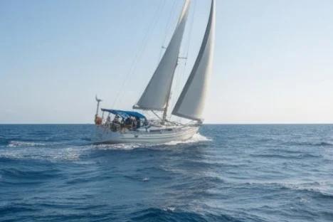
The passage
East in the westerlies at 30 to 35° S, then north to Tubuai or Raivavae and Tahiti; about 2,200 NM, often rough.
The usual stops
- Raivavae, Austral Islands (23.87° S, 147.67° W)
Ocean currents
- Leeuwin Current: flows south, about 0.7 knots. A warm current running south along Western Australia, strongest in the southern winter.
- Agulhas Current: flows south-west, about 3 knots. The Agulhas runs south-west along the South African coast at 2 to 5 knots, strongest near the edge of the continental shelf. A south-westerly gale against it raises enormous, steep waves (freak waves have broken ships): move only on a north-easterly window and be in port before the next front. Keep inside the 200 m line when a south-westerly comes, outside it for the full push.
- Benguela Current: flows north-west, about 0.6 knots. Sets north-west from the Cape: with the south-east trades it gives an easy ride to St Helena.
- Brazil Current: flows south-west, about 0.6 knots. Sets south-west along Brazil south of Salvador, about half a knot.
- Humboldt Current: flows north, about 0.6 knots. Cold water setting north along Chile and Peru; it turns west into the South Equatorial Current near the Galápagos.
When not to go
Southern winter gales, or the cyclone season in the islands. Avoid: July to August, December to February.
Where you leave: Southern Australia and New Zealand
- May to August: Winter lows in the Tasman Sea and southern Australia: gales and big seas.
- all year: Bass Strait is shallow and exposed: wait for a settled window to cross.
Tides: Moderate tides (1.5 to 3 m), with strong streams in Bass Strait, Cook Strait and Port Phillip Heads. The year in Southern Australia and New Zealand →
Where you arrive: French Polynesia
- November to April: Cyclone season, November to April (rare in the Marquesas, more frequent in the west).
Tides: Small tides (30 to 50 cm), but strong currents in the Tuamotu passes: enter at slack water, best with the sun behind you. The year in French Polynesia →
Before you go
- Plan to leave in April to May (possible, with more care: March, June).
- Be across or in port before July to August, December to February: Southern winter gales, or the cyclone season in the islands.
- Plan water, fuel and provisions around the usual stops: Raivavae, Austral Islands.
- Allow for the Leeuwin Current on the way: it flows south at about 0.7 knots.
- Allow for the Agulhas Current on the way: it flows south-west at about 3 knots.
- Allow for the Benguela Current on the way: it flows north-west at about 0.6 knots.
- Allow for the Brazil Current on the way: it flows south-west at about 0.6 knots.
- Allow for the Humboldt Current on the way: it flows north at about 0.6 knots.
- Read the 3 local notes for your months under "Where you leave" and "Where you arrive" above.
- Get a weather routing or a careful look at the GRIB files for the whole passage, and leave on a window, not a date. Cruisers say the most dangerous thing on a boat is a schedule.
- Check the boat as for any ocean passage: rig, steering, self-steering, bilge pumps, through-hulls, liferaft and EPIRB, water and fuel for the calms.
- Read the entry rules of the country you arrive in a few months ahead: permits, advance notice, biosecurity.
- Tell someone ashore your plan and when to raise the alarm.
Sailing it the other way: there is no direct passage back in the almanac; it goes in two legs:
- Coconut Milk Run (Tahiti to Tonga and Fiji) (best June to September), then Islands to New Zealand or Australia (best October to November)
Passages from where you arrive
Plan a route World voyage planner
Seasons are averages from long experience and the pilot charts: a good month can still bring a gale, and storms sometimes come outside their season. Check the official forecasts before every passage.