Virgin Gorda, North Sound and Anegada

The eastern BVI: the granite boulders of the Baths, the reef-sheltered North Sound, the Dogs, and the low coral island of Anegada for those who can read the water.
JFMAMJJASOND
The region
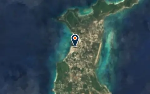
Virgin Gorda is the eastern anchor of the Sir Francis Drake Channel and has a different feel from Tortola: drier, more open, with long views. Its south-west corner is famous for the Baths, where giant granite boulders form pools and passages along the beach. Spanish Town, with the Virgin Gorda Yacht Harbour, is the main settlement and a port of entry.
At the north end, North Sound (also called Gorda Sound) is a large lagoon enclosed by reefs and small cays, entered through marked channels. It is one of the best-protected bodies of water in the islands, with Leverick Bay, the Bitter End area and Saba Rock inside. Between Virgin Gorda and Tortola lie the Dogs, small uninhabited islands with day moorings for snorkelling.
Anegada, about 12 miles north, is the odd one out: a flat coral island only a few metres high, surrounded by Horseshoe Reef, one of the largest barrier reefs in the Caribbean. It is known for lobster, empty beaches and flamingos in its salt ponds. The approach to the anchorage off Setting Point follows a marked channel through shallow water; it is an eyeball passage in good light, and some charter companies do not allow their boats to go there.
Winds and season
Same trade-wind pattern as the rest of the BVI: north-east to east, usually 12 to 20 knots, stronger around December to February. Virgin Gorda is more exposed than Tortola, and the passage to Anegada is open water with a following or beam sea. The Baths and other west-facing day stops become dangerous in a northerly swell, when the National Parks Trust may fly a red flag and close the beach to swimmers. The Atlantic hurricane season runs from 1 June to 30 November, with the most activity from August to October.
Getting there
- Virgin Gorda (VIJ), Spanish Town about 19 km from the middle of the region
- Terrance B. Lettsome (EIS), Beef Island about 28 km from the middle of the region
- Cyril E. King (STT), Charlotte Amalie about 74 km from the middle of the region
Straight-line distance; by road it is usually a third longer. Each marina page gives its own nearest airports.
Legs along the coast
| To | About | At 6 knots |
|---|---|---|
| Tortola, Jost Van Dyke and the Sir Francis Drake Channel | 30 NM | 5 h, a day sail |
Middle of one region to the middle of the next, with a quarter added for the coast and the wind. Plan the real legs in the route planner.
Want company on these waters? Find a buddy boat or crew on Sail together.
Where to stop
- The Baths
Day moorings only; swim ashore through the surf line, the dinghy must stay outside the swim area. - Spanish Town and Virgin Gorda Yacht Harbour
Port of entry with marina, fuel, water and shops. - Savannah Bay
Long beach and reef on the west coast, settled weather only. - Leverick Bay, North Sound
Moorings, fuel and a small resort on the south side of the Sound. - Bitter End area and Saba Rock
Eastern end of North Sound, sheltered behind the reef. - The Dogs
Small islands between Tortola and Virgin Gorda with day moorings for snorkelling. - Setting Point, Anegada
Anchorage and moorings after the marked channel through the reef. - Loblolly Bay, Anegada
North shore beach with reef snorkelling, reached by land from the anchorage.
Been here? Rate a cove in a few taps and the next skipper will thank you.
Anchoring and mooring
North Sound has good sand holding in places but large areas are filled with moorings; read the chart for the shallow patches near the reefs. At Anegada, anchor or pick up a mooring only after following the channel markers, and keep a watch on depth.
A one-week route
A realistic loop for a week, with short days you can stretch or cut to the weather. Check every leg on the chart and the route planner.
- From the Tortola side to Spanish Town, clear in or provision.
- Early start to the Baths day moorings, then on to the Dogs for lunch.
- The Dogs to North Sound, settle in for two nights.
- Dinghy and snorkel around the reef and cays of North Sound.
- North Sound to Anegada through the marked channel, midday light.
- Anegada by land: Loblolly Bay and the salt ponds.
- Anegada back to North Sound or down to Tortola.
Rules and protected areas
Clearing in: Spanish Town on Virgin Gorda is a port of entry with Customs and Immigration. If you arrive from the east, clear in there before visiting other islands. Step by step in Arriving by boat in British Virgin Islands.
Fuel, water, repairs and supplies
Virgin Gorda Yacht Harbour in Spanish Town has fuel, water, a haul-out yard and the island's main shops. Inside North Sound there are fuel and water at the marinas and small provisioning stores. Anegada has very little: a few restaurants and shops, so arrive provisioned and with full water tanks.
 United Kingdom
Boat services
All boat services →Wind here, next 7 days
The forecast loads as you scroll.
Hour by hour, waves and sunset → · Data: MET Norway (CC BY 4.0). Always check the official marine forecast before you leave.
Questions about Virgin Gorda, North Sound and Anegada
Can I take my boat to Anegada?
Yes, in good light, following the marked channel to Setting Point. Check your draft against the chart, and if you are on a charter boat, check your contract first.
How do I visit the Baths by boat?
Pick up a National Parks day mooring early in the morning and swim ashore. If the red flag is up, the beach is closed because of swell.
Is North Sound safe in bad weather?
It is one of the best-protected anchorages in the BVI, enclosed by reefs, but it is not a hurricane hole for a named storm.
Cruising nearby
Written by the Boat Almanac editors from charts, official notices and boaters' reports; lists are updated from the almanac every day. Something changed? Suggest a correction.