Kuşadası, Didim and the Güllük gulf
The map opens as you scroll to it
Large marinas and yards opposite Samos, with the Dilek peninsula and the Güllük gulf.
JFMAMJJASOND
The region
Kuşadası has a big marina in town and faces the Greek island of Samos across a short strait. South of it, the Dilek peninsula is a national park with steep green hills, and the coast then opens into the wide Büyük Menderes delta.
Didim's marina, at the southern end, is one of the largest on the Aegean coast and many foreign owners keep their boats there over winter. The Güllük gulf beyond is a working gulf with fish farms, a small harbour at Güllük and quieter bays towards Bodrum.
Winds and season
The summer meltem blows from the north to north-west, often strong in the afternoons in the Samos strait. Didim is open to the north, so the marina is the comfortable place to be when it blows. Spring and autumn give lighter winds and fewer boats.
The region in numbers
Counted from the records on Boat Almanac, November 2026. A number missing or wrong? Correct it on the place's page, and it helps the next crew planning here.
Shelter by wind
Where boats in this region find shelter when the wind blows from each direction. From the route data and sailors' reports; check the forecast and your chart, as swell can wrap round headlands.
| Wind from | Sheltered |
|---|---|
| N | Ilıca Bükü – Çomça, Kazıklı Liman |
| NE | Kazıklı Liman |
| E | Ilıca Bükü – Çomça, Kazıklı Liman |
| SE | Ilıca Bükü – Çomça, Kazıklı Liman |
| S | Ilıca Bükü – Çomça |
| SW | Ilıca Bükü – Çomça, Kazıklı Liman |
| W | Ilıca Bükü – Çomça, Kazıklı Liman |
| NW | Kazıklı Liman |
Getting there
- Samos (SMI), Samos Island about 37 km from the middle of the region
- Milas Bodrum (BJV), Bodrum about 48 km from the middle of the region
- Adnan Menderes (ADB), Gaziemir about 82 km from the middle of the region
Straight-line distance; by road it is usually a third longer. Each marina page gives its own nearest airports.
Legs along the coast
| To | About | At 6 knots |
|---|---|---|
| İzmir, Çeşme, Urla and Karaburun | 75 NM | 2 days of about 8 h |
| Bodrum peninsula | 40 NM | 7 h, a day sail |
Middle of one region to the middle of the next, with a quarter added for the coast and the wind. Plan the real legs in the route planner.
Want company on these waters? Find a buddy boat or crew on Sail together.
Where to stop
- Kuşadası
Marina in town, close to Ephesus. - Dilek peninsula
National park coastline; check the park's mooring rules before you stop. - Akbük (Didim)
Long bay east of Didim, sheltered from the north. - Didim
Large marina with a big hardstanding. - Güllük
Working harbour and fishing town. - Iasos
Ancient city on a small peninsula in the Güllük gulf, with anchorages next to the ruins. - Altınkum
Long sandy beach at Didim; fine for a swim stop in settled weather. - Kazıklı bay
Deep, quiet bay in the Güllük gulf, good shelter from the north. - Davutlar coast
Beaches south of Kuşadası on the way to the national park.
Harbours and anchorages on the route planner
| Place | Type | Fuel | Water | Pump-out | Shelter |
|---|---|---|---|---|---|
| Didim | Marina | Fuel dock | Yes | Yes | |
| Kuşadası | Marina | Fuel dock | Yes | Yes | |
| Güllük | Harbour | ||||
| Ilıca Bükü – Çomça | Anchorage | sheltered from N, E, SE, S, SW, W; open to NE | |||
| Kazıklı Liman | Anchorage | sheltered from N, NE, E, SE, SW, W, NW |
Positions are approximate. Plan a passage between any two of them in the route planner.
Been here? Rate a cove in a few taps and the next skipper will thank you.
Anchoring and mooring
The bays along the Dilek peninsula and around Akbük are mostly sand with patches of weed and good holding. In the national park parts of the Dilek coast, anchoring and landing rules are stricter; check the current signs and notices before you drop the hook. The north wind funnels around the headlands, so look for bays tucked in on the south side. Stern-to with a line ashore is common in the smaller coves of the Güllük gulf, where room is tight in summer.
A one-week route
A realistic loop for a week, with short days you can stretch or cut to the weather. Check every leg on the chart and the route planner.
- Kuşadası to a bay on the south side of the Dilek peninsula, about 15 NM. Watch the strait off Samos, it is a border.
- Dilek bays to Akbük (Didim), about 20 NM. Calm water and a quiet resort.
- Akbük to Didim marina, about 12 NM. Visit the Temple of Apollo at Didyma inland.
- Didim to Güllük, about 15 NM. Fishing town at the head of the gulf.
- Güllük to bays near Iasos, about 6 NM. Ancient city ruins by the water.
- Iasos to Didim, about 20 NM. Fuel and water.
- Didim to Kuşadası, about 30 NM. A longer last leg, better done early.
Rules and protected areas
Clearing in: Kuşadası, Didim and Güllük are frontier ports. Step by step in Arriving by boat in Turkey.
Fuel, water, repairs and supplies
Didim has a large yard with travel lifts, winter storage and most trades on site; Kuşadası has lift-out and service firms too. Fuel and water are at both marinas. Milas-Bodrum airport is close to Güllük.
Marinas
All marinas in Turkey → Didim
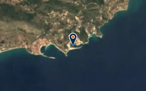 MarinaSamos MarinaSamos 133 berths Boats up to 25 m VHF CH 09 Fuel · Water · Power · Wi-Fi · Showers MarinaSetur Kuşadası MarinaKuşadası 657 berths Boats up to 90 m VHF 16 / 73One of the largest marinas on the Turkish Aegean with 557 berths, full customs and immigration facilities… MarinaDavutlar LimanıKuşadasıDavutlar Limanı is a marina in Turkey. MarinaDidim-Akbük Fishing HarbourDidimDidim-Akbük Fishing Harbour is a marina in Turkey. MarinaEgesu Güllük MarinaGüllük 350 berths VHF 72Egesu Güllük Marina is a marina in Turkey. It has about 350 berths. VHF channel 72. MarinaGüzelçamlı LimanıDavutlarGüzelçamlı Limanı is a marina in Turkey.
 Samos
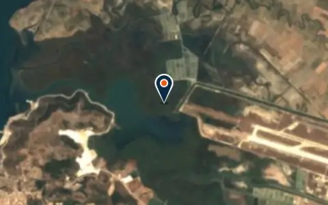 MarinaMandalya MarinaGüllük 50 berthsSmall, peaceful marina in the unspoilt Güllük bay, an alternative to the busy Bodrum anchorages. MarinaPythagorion MarinaSamos 200 berthsUNESCO World Heritage harbour on Samos, Pythagoras was born here.
Boatyards and haul-out
All boatyards in Turkey →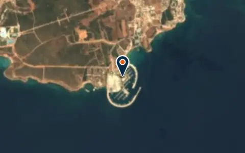 BoatyardDidim BoatyardDidim 100 t lift Hard-standing 591 berths Boats up to 70 m VHF 16Operated in association with D-Marin, Didim Boatyard offers a well-equipped 100-tonne travel lift and a secure hardstand suitable… BoatyardKaraca Marin Tekne ParkDidim Hard-standingKaraca Marin is a boat park and winter storage yard in the Hisar area on the north side…
Boat services
All boat services →Charter
All charter →Wind here, next 7 days
The forecast loads as you scroll.
Hour by hour, waves and sunset → · Data: MET Norway (CC BY 4.0). Always check the official marine forecast before you leave.
Questions about Kuşadası, Didim and the Güllük gulf
Can I sail to Samos from Kuşadası?
Only if you clear out of Turkey and into Greece at official ports; the strait between the Dilek peninsula and Samos is a border. Do not stop on the Greek side without clearing in.
Is Didim a good base for the winter?
Didim's large marina is a popular place to leave a boat over winter, with a boatyard, chandlers and a live-aboard community. Check current prices and contract terms directly with the marina.
What is there to see ashore?
This stretch has some of the richest ancient sites on the coast: Ephesus near Kuşadası, Priene and Miletus, the Temple of Apollo at Didyma and Iasos by the sea.
Cruising nearby
Written by the Boat Almanac editors from charts, official notices and boaters' reports; lists are updated from the almanac every day. Something changed? Suggest a correction.