İzmir, Çeşme, Urla and Karaburun
The map opens as you scroll to it
Turkey's third city, its sheltered gulf, and the windy Çeşme peninsula opposite Chios.
JFMAMJJASOND
The region
İzmir sits at the end of a long gulf with marinas in the city, at Levent and further out at Foça and Urla. The Urla islands and the Karaburun peninsula give sheltered day sails close to town, and Foça, with its old harbour and protected monk seal waters, is a short hop north.
The Çeşme peninsula, at the western tip, faces Chios. Çeşme and Alaçatı are busy summer towns with good marinas; Sığacık, on the south side, has a quiet marina next to the ruins of Teos.
Winds and season
In summer the imbat, a steady north-westerly sea breeze, fills in most afternoons and blows up the İzmir gulf. Around Çeşme and Alaçatı the wind is stronger and more frequent; this is one of the windiest corners of the Turkish coast. Mornings are usually the calmest time to move.
The region in numbers
Counted from the records on Boat Almanac, November 2026. A number missing or wrong? Correct it on the place's page, and it helps the next crew planning here.
Getting there
- Chios Island National (JKH), Chios Island about 41 km from the middle of the region
- Adnan Menderes (ADB), Gaziemir about 50 km from the middle of the region
- Balıkesir Koca Seyit (EDO), Edremit about 133 km from the middle of the region
Straight-line distance; by road it is usually a third longer. Each marina page gives its own nearest airports.
Legs along the coast
| To | About | At 6 knots |
|---|---|---|
| North Aegean | 75 NM | 2 days of about 8 h |
| Kuşadası, Didim and the Güllük gulf | 75 NM | 2 days of about 8 h |
Middle of one region to the middle of the next, with a quarter added for the coast and the wind. Plan the real legs in the route planner.
Want company on these waters? Find a buddy boat or crew on Sail together.
Where to stop
- Foça
Old harbour and islands; the area protects the Mediterranean monk seal. - Urla islands
Short hops and quiet anchorages close to İzmir. - Ildırı
Bay near ancient Erythrai on the Çeşme peninsula. - Dalyanköy
Fishing harbour north of Çeşme with restaurants. - Sığacık and Teos
Walled village, marina and ancient harbour. - Karaburun
Wild peninsula with few facilities; good in settled weather. - Alaçatı
Marina and lively village; famous windsurf bay. - Mordoğan
Small harbour town on the Karaburun peninsula's west coast. - Gülbahçe
Shallow bay near Urla with a yacht club scene. - Teos ancient harbour
Ruins right by the water near Sığacık, a short walk from the anchorage.
Harbours and anchorages on the route planner
| Place | Type | Fuel | Water | Pump-out | Shelter |
|---|---|---|---|---|---|
| Alaçatı Marina | Marina | Fuel dock | Yes | Yes | |
| Sığacık (Teos Marina) | Marina | Fuel dock | Yes | Yes | |
| Yeni Foça (Oasis Marina) | Marina | Fuel dock | Yes | Yes | |
| Çeşme | Marina | Yes | Yes | ||
| İzmir – Alsancak | Marina | Yes | Yes | ||
| İzmir – Levent Marina | Marina | Yes | Yes | ||
| Foça | Harbour | By tanker | |||
| Dalyan (Çeşme) | Harbour | ||||
| Mordoğan | Harbour | ||||
| Saipaltı fishing harbour | Harbour | ||||
| Urla | Harbour | ||||
| Ildır | Anchorage | ||||
| Kara Ada (Çeşme) | Anchorage | ||||
| Karaburun (south of Büyük Sahip Adası) | Anchorage |
Positions are approximate. Plan a passage between any two of them in the route planner.
Been here? Rate a cove in a few taps and the next skipper will thank you.
Anchoring and mooring
Expect sand and weed in most bays, with good holding once the anchor is through the weed; take time to dig in and back down firmly. The Çeşme peninsula catches the full force of the north wind in summer, so the south-facing bays such as Ildırı's inner bay and the Urla islands are the usual shelter. Near Alaçatı the wind that makes it famous for windsurfing also makes it a poor overnight anchorage in a blow. Restaurants in the Urla islands and Dalyanköy sometimes have small jetties or moorings for customers; ask before tying up.
A one-week route
A realistic loop for a week, with short days you can stretch or cut to the weather. Check every leg on the chart and the route planner.
- Çeşme marina to Dalyanköy, about 5 NM. A gentle start and fish dinner in the fishing village.
- Dalyanköy to Ildırı, about 12 NM. Ancient Erythrai above the bay, good shelter from the north.
- Ildırı to the Urla islands, about 15 NM. Several anchorages, choose by wind direction.
- Urla islands to Karaburun harbour, about 20 NM. Wilder coast and a quiet small town.
- Karaburun to Foça, about 25 NM across the gulf mouth. Watch for ships heading to İzmir.
- Foça back towards Urla, about 25 NM, or a rest day in Foça if the wind is up.
- Urla to Çeşme, about 25 NM around the peninsula. Round the north-western corner early, before the afternoon wind.
Rules and protected areas
Clearing in: İzmir and Çeşme are frontier ports. Step by step in Arriving by boat in Turkey.
Fuel, water, repairs and supplies
İzmir has the full range of chandlers, engine dealers and service firms. Çeşme, Alaçatı and Sığacık marinas have fuel, water and lift-out; Urla and Levent have yards used for winter storage.
Marinas
All marinas in Turkey → Alaçatı
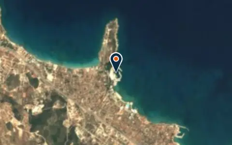 MarinaSetur Çeşme MarinaÇeşme 246 berths Boats up to 45 m VHF 73Çeşme · 186 berths · max. 45 m MarinaTeos MarinaSeferihisar VHF 72Teos Marina is a marina in Seferihisar, Turkey. Marina2. LimanIzmir2. Liman is a marina in Izmir, Turkey. MarinaBostanlı BarınağıIzmirBostanlı Barınağı is a marina in Turkey. MarinaBüyüklimanÇeşmeBüyükliman is a marina in Turkey.
 MarinagridiaThymianagridia is a marina in Greece. MarinaMordoğan HarbourMordoganMordoğan Harbour is a marina in Turkey. MarinaÖzdere LimanıOzdereÖzdere Limanı is a marina in Turkey. MarinaPaşalimanıÇeşmePaşalimanı is a marina in Turkey.
 Thymiana
 MarinaTeos MarinaSeferihisar 560 berthsQuiet, well-run marina near the Sığacık lagoon, popular with those exploring the northern Aegean anchorages.
Boatyards and haul-out
All boatyards in Turkey → BoatyardÇeşme BoatyardÇeşme 50 t lift Boats up to 18 m VHF 16A smaller, family-run yard at the tip of the Çeşme peninsula, conveniently positioned for vessels arriving from the… BoatyardÇeşme Marin Yacht & Boat ParkÇeşme Hard-standingÇeşme Marin is a yacht and boat park in the Fahrettinpaşa district on the eastern side of Çeşme,… BoatyardAliağa Gemi Söküm TesisleriAliağaAliağa Gemi Söküm Tesisleri is a boatyard in Aliağa, Turkey. BoatyardRedline/Active Emergancy Rescue Boat FRAlaçatıRedline/Active Emergancy Rescue Boat FR is a boatyard in Alaçatı, Turkey.
Boat services
All boat services → BusinessFırat MarinÇeşmeMaintenance/Repair · +90 532 418 10 81
 BusinessKalfa Marin Chandlery & Parts · ÇeşmeYat market / Tamir-Bakım · +90 537 414 05 67 BusinessMarina TeknosaÇeşmeMarina Teknosa is a marine business in Çeşme, Turkey. Confirm berths, prices and services directly with the business… BusinessTeos Marina AVMSeferihisarTeos Marina AVM is a marine business in Seferihisar, Turkey. Confirm berths, prices and services directly with the… BusinessTeos Marina Spa & BeautySeferihisarTeos Marina Spa & Beauty is a marine business in Seferihisar, Turkey. Confirm berths, prices and services directly…
Charter
All charter →Wind here, next 7 days
The forecast loads as you scroll.
Hour by hour, waves and sunset → · Data: MET Norway (CC BY 4.0). Always check the official marine forecast before you leave.
Questions about İzmir, Çeşme, Urla and Karaburun
Is Alaçatı a good place to stop by boat?
Alaçatı has a marina, but the bay is famous for strong, steady wind, which is great for windsurfers and less fun for sleeping at anchor. Most yachts stay in the marina there or use Çeşme and the bays further east.
Is Foça worth the detour?
Yes. It is one of the most attractive small towns on the coast, with two harbours and protected waters around the islands offshore. Part of the area is a seal protection zone, so follow the local rules on speed and anchoring.
How busy is İzmir Bay with shipping?
The approach to İzmir port carries big ships and ferries. Cross the main channel at right angles, keep a lookout and listen to the VHF; inside the bay, small craft traffic is heavy at weekends.
Cruising nearby
Written by the Boat Almanac editors from charts, official notices and boaters' reports; lists are updated from the almanac every day. Something changed? Suggest a correction.