Navigation and pilotage
Modern navigation is easy until it is not. A chartplotter shows your position to a few metres on a chart that may have been surveyed a century ago, by lead line, and may be shifted from the real coast by hundreds of metres. The skills of the past still matter: knowing what the chart can and cannot tell you, reading the water, and having a plan when the screens go dark.
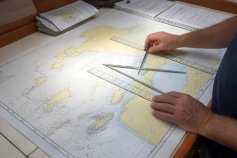
Charts: paper and electronic
- Electronic charts are convenient and accurate where the survey is good; they are only as good as the survey underneath. Zoom in only as far as the chart's scale allows; beyond that you see detail that is not there.
- Carry paper charts or a second, independent electronic system for the areas you sail, and keep them updated with the notices to mariners where you can.
- Read the source data where the chart shows it: the date and method of survey. A survey from the 19th century, common in parts of the Pacific and the Indian Ocean, can show reefs in the wrong place or miss them.
- Use more than one chart source in poorly surveyed areas, and satellite images (downloaded before you go) to see reefs and channels.
Datum and offsets
Positions from the GPS use one datum (WGS84). Many old charts use other, local datums; even when converted, some remote charts are offset from reality by hundreds of metres. In those places the plotter can show the boat sailing over land while she is in deep water, or worse, in deep water while she is on a reef. Navigate by eye and depth there, not by the plotter alone.
Eyeball navigation in coral
- Enter coral areas with the sun high and behind you (late morning to mid-afternoon), with a person on the bow or up the mast to read the water.
- Colours tell depth: dark blue is deep, light blue and green shallow, brown and yellow-brown is reef or rock near the surface, white is breaking water or sand very shallow.
- Polarised sunglasses help a lot. Overcast skies, low sun and glare make reefs invisible: wait.
- Go slowly, and agree hand signals between the bow and the .
Pilotage: leading lines and transits
- A leading line (two marks or lights in line) keeps you in a channel: steer to keep them in line and watch them, not the compass.
- A clearing line keeps you off a danger: a bearing you must stay on one side of.
- Transits (two objects in line) check your position faster and more reliably than any instrument; use them to check the GPS and the anchor.
- Write the plan before entering: the bearings, the marks to look for, the depths expected and the point where you turn back if it does not look right.
Tidal heights and streams
Outside the Mediterranean, the tide changes depths by metres and sets the boat sideways in the streams. Work out the height of tide for bars, shallow entrances and anchorages (see the tide height tool), and the course to steer across a stream (course to steer). Plan to pass tidal gates and headlands with the stream, never wind against tide.
When the GPS fails
- Write the position, course, speed and log reading in the logbook every hour: from the last fix you can work a dead reckoning position.
- Carry a handheld GPS with spare batteries, and a phone with offline charts, kept in a metal box (the oven) in thunderstorms.
- Know how to take a bearing with the hand-bearing compass, and to fix the position from two or three bearings near the coast.
- For ocean passages, a sextant and the skill to use it is the backup that cannot fail; at least know a noon sight for latitude.
- GPS signals can be jammed or spoofed in some regions: if the position looks wrong, check with depth, bearings and radar.
Seasonal timing
- Northern temperate waters
- Before the season: update the charts and the plotter software, and check the handheld GPS batteries.
- Southern temperate waters
- The same before the southern season.
- The tropics
- Before a tropical season: download satellite images of the reefs and passes you plan to visit while you have good internet.
Tips from experience
- Download satellite images of reef areas before you lose internet.
- Keep the depth alarm set at a sensible depth.
- Check the plotter position against a transit or a bearing when entering harbour.
- Write the pilotage plan for difficult entrances on a card for the cockpit.
- In coral, never trust the chart alone; trust the eyes on the bow.
- Learn the buoyage region (A or B) of each area before arriving.
- Use the radar to check distances off the coast, independently of the GPS.
- Carry a hand-bearing compass and use it.
- Charts have long carried the warning that a prudent mariner does not rely on any single aid to navigation. Cross-check the plotter with the depth sounder, a bearing and your own eyes.
What it usually costs depends on
- Chart packages for the regions you sail, and updates.
- A backup GPS and charts on a second device.
- A sextant and tables if you want the full independent backup.
Ask for written quotes locally: prices differ a great deal between countries, harbours and seasons.
Common mistakes, and the lesson from each
- ❌ Trusting the plotter in poorly surveyed areas. Old surveys and datum offsets put reefs in the wrong place. Navigate by eye there.
- ❌ Zooming in beyond the chart's scale. You see detail that was never surveyed.
- ❌ Entering coral with the sun ahead or low. Reefs disappear in glare. Go with the sun high and behind you.
- ❌ No dead reckoning in the log. When the GPS fails, the last logged position is your start.
- ❌ Ignoring the tide outside the Med. Depths change by metres and streams set you sideways. Plan with the tide.
- ❌ One device for everything. Keep an independent backup for position and charts.
- ❌ Not knowing the buoyage region. Red and green swap sides between regions A and B. Brief the crew.
- ❌ No turn-back point in a pilotage plan. Decide before you enter where you abort if it looks wrong.
Go deeper
- Tide height (rule of twelfths)
- Course to steer
- Position and distance
- Compass
- Chart reading and navigation guide
- Radar guide
- Route planner
← The Skipper's Handbook · ‹ Night sailing and watchkeeping · The dinghy and the outboard ›
General guidance from experience, not instructions for your boat: follow the maker's manuals and ask a qualified professional for work you are not sure of.