Marina
Nanny Cay Marina
 Road Town, British Virgin Islands
Contact & actions
More: share, map, compare
Key facts
| VHF channel | 16 |
|---|---|
| Position | 18° 23.915′ N64° 38.175′ W |
Facilities at a glance
- Restaurant
- Chandlery
- Travelift
- Water
- Electricity
- Showers & toilets
- Pump-out
- Parking
- Market nearby
- Restaurants nearby
- Fuel
- Market
- Crane
- Security & CCTV
- Technical service
- Wi-Fi
- Laundry
Not known yet. Been there? Tap one to add it:
911 or 999 · VHF 16 110 V / 60 Hz US dollar Non-Schengen
Updated Boat Almanac editors Suggest a correction
Closest marinas
 TradeWinds British Virgin IslandsRoad Town · 0.1 NM
 Horizon Yacht ChartersRoad Town · 0.1 NM
 Prospect Reef MarinaRoad Town · 1.4 NM
Straight-line distance; check the chart for the route.
Storm season in Road Town: hurricane or cyclone months, so secure storage, tie-downs, insurance and the forecast come first.
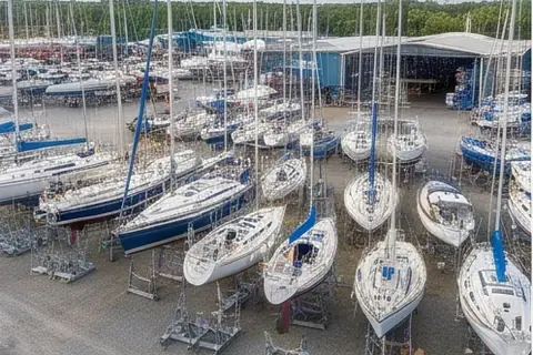
Nanny Cay Marina sits on the sheltered south shore of Tortola and is a favourite landfall for sailors completing an Atlantic crossing, with easy customs clearance and a well-stocked chandlery steps from the docks. Anchoring is available in the bay outside, and the marina’s provisioning options, fuel dock, and on-site boatyard make it a complete base for exploring the British Virgin Islands.
Around the marina (within 1 km)
Shops, food and services within walking distance of Nanny Cay Marina, nearest first. Check opening hours before you go.
Provisions & groceries 1
- C & D Supermarket Supermarket · 250 mMap
Restaurants & cafés 3
Bars & pubs 1
- Capt´n Mulligans Pub · 430 mMap
Places to stay 1
- Nanny Cay Resort and Marina Hotel · 210 mMap
Source: © OpenStreetMap contributors (ODbL). Updated October 2026.
Getting here
- Terrance B. Lettsome (EIS), Beef Island11 km
- Cyril E. King (STT), Charlotte Amalie (U.S. Virgin Islands, across a border)37 km
Nearest airports with scheduled flights, distance in a straight line; by road it is usually a third longer. Airport list: OurAirports.
Captain reviews
No reviews yet. Used it? Tap your stars at the top of the page: it takes a second and helps the next captain choose.
★ Write a review or add photos
Know a sailor who knows Nanny Cay Marina? Invite them on WhatsApp
About this information
- Who runs itNot yet claimed by the business.
- Phone, e-mail, website, addressNot checked yet. Call before you go.
- Facilities and capacityNot checked yet. Call before you go.
Where it comes from: OpenStreetMap, the open map kept by volunteers. Last edit 22 Oct 2026.
Parts of this page are due for a check. Been here lately? A short note helps the next crew.
What boaters paid here
No prices shared for Nanny Cay Marina yet. Paid for a berth or a job here? It takes a minute and helps the next skipper plan.
+ Paid here this season? Add it
Sailing here
Nanny Cay Marina is in Caribbean and Bahamas. November: storm season, hurricane, cyclone or typhoon months: secure storage, tie-downs, insurance and the forecast come first.
- Book haul-out and storm-season storage ashore in May, before the yards fill.
- Storm season: June to November. Ask about tie-downs, a storm plan and what your insurance covers here in those months.
This month: Atlantic hurricane season, 1 June to 30 November, peak August to October. Know your hurricane hole, keep the boat ashore and strapped down or out of the belt, and check what your insurance covers. Many boats go south to Grenada or Trinidad for these months.
The year here, tides, currents and onward passages
Tides: Very small tides (20 to 50 cm) in the Caribbean; up to 1 m in the Bahamas, where the tide matters for the shallow cuts.
Ocean currents nearby
- Caribbean Current: flows west, about 1 knot. West-going through the Caribbean at about a knot, up to 2 knots off Colombia, where it meets the strongest trades: a big, steep sea off Cabo de la Vela in the winter.
Ocean passages from this sea area: Caribbean to the Azores (eastbound Atlantic) (best May to June); Caribbean to Florida (best March to May); Caribbean to the US east coast (best May); Caribbean to Panama and through the Canal (best January to March).
Seasons are averages; check the forecast before every passage. Plan a route from here
Sea and sky now
The conditions load as you scroll.
Computer model for this point, not a harbour report. Always check the official marine forecast before you leave. Data: Open-Meteo.com (CC BY 4.0).
Wind here, next 7 days
The forecast loads as you scroll.
Hour by hour, waves and sunset → · Data: MET Norway (CC BY 4.0). Always check the official marine forecast before you leave.
Keep an eye on Nanny Cay Marina
One short email on Friday morning: the weekend wind here, what boaters added this week (reviews, prices, corrections) and events nearby. Nothing else, and one click stops it.
Cruising this region
Tortola, Jost Van Dyke and the Sir Francis Drake Channel: The classic BVI loop: Road Town and Nanny Cay, the Norman Island caves, the Rhone wreck and the beach bars of Jost Van Dyke, all within a few miles of sheltered water. Winds, where to stop, rules and every marina and service nearby.
Marinas and bays nearby
Marinas
- TradeWinds British Virgin Islands0.1 NM
- Horizon Yacht Charters0.1 NM
- Prospect Reef Marina1.4 NM
- Village Cay Marina1.8 NM
- The Moorings Marina, Tortola2.1 NM
Bays and anchorages
- Brewer's Bay2.8 NM
- Paraquita Bay3.7 NM
- Sopers Hole4.0 NM
- Hansen Bay4.1 NM
- Princess Bay4.2 NM
- Elk Bay4.2 NM
All bays around Road Town on the map →
Distances in nautical miles in a straight line, not the way round headlands. Check the chart for the route.
Arriving from abroad? Entry and clearance in British Virgin Islands: ports of entry, papers, fees and how long you may stay.
🟩🟥 Buoyage here: IALA region B. Coming in from sea, keep red to starboard (right) and green to port. Marks explained
Ask for quotes near here
Write once. We send your request to the three businesses closest to Nanny Cay Marina that list what you need, and they answer you directly. Free, nothing binding.
Latest conditions
Loading what sailors reported…
Here now? Tap what you see here. One tap, no account, and the next sailor knows before they come.
Been here lately? Was this page right?
No sailor has told us about a visit yet. If you have been here, it takes a minute and helps the next crew.
Tell sailors about your visit
Ask sailors who have been here
No questions yet. Wondering about the depth at the fuel dock, the walk to the shops or whether they answer the VHF at night? Ask here.
Ask a question
Sailors around here
No notes right now. Here for a few days? Say so: a shared taxi, a spare part or a hand with the lines is often one note away.
Leave a note
Looking for crew, a boat to crew on or a buddy boat for a passage? Sail together is the board for that.
Cite this page
Nanny Cay Marina. Boat Almanac, updated 22 October 2026. https://boatalmanac.com/marinas/nanny-cay-marina/ (accessed 21 November 2026).
Map position: © OpenStreetMap contributors (ODbL).
Quick guide for captains: Road Town
How big a boat can come in?
The limits are in Key facts above. Figures change with dredging and the berth you are given: tell the office your length, beam and draft when you call, and ask for a berth that suits them.
Is the fuel dock open all year?
Fuel docks often keep shorter hours out of season: check before you plan to arrive on a low tank.
How do I call them on arrival?
On VHF channel 16, about half an hour before you arrive. By phone on +1 (284) 541 2468, or the day before in the busy season. Have your boat's name, length, beam, draft and the number of nights ready, and fenders and lines rigged on both sides before you enter.
When is it busy, and when should I book?
The sailing season here (Caribbean and Bahamas) runs January to April; book ahead for those months. Book haul-out and winter places in May. Storm season: June to November; ask about the place's storm plan and what your insurance covers here then.
Contact this business
This listing has not been claimed yet, so we cannot forward messages from here. Phone and website are shown above; you can contact them there. If you want quotes from several businesses at once, use the single form.
Related articles
 Wintering a yacht in Turkey: marinas, haul-out, costs, paperworkTurkey has become one of the most popular places in the Mediterranean to lay up a…
 Living Aboard in Winter: Heating, Condensation and Staying SaneMany cruisers spend the winter living aboard in a marina, waiting for the next season. With…
 The 5 Stages of Winter Lay-Up Denial: Why We All Pretend We’re Going to “Work on the Boat Every Weekend”Let’s talk about the biggest, most widely accepted collective delusion in the entire maritime world: The…
Owner & corrections
Run this place? Claim the page
Clear details and fair prices help sailors find you, and help them trust what they find.
Claim the page with your e-mail address: you get a free business account where you keep the details, photos and prices right and answer reviews and questions. Messages from sailors come straight to you, and once a month you see how many opened, called and saved your page. We check every claim before the page is linked to you; a claimed page shows "✓ Claimed".
3 details are missing here, or something is wrong? Fix it
Listing and claiming are free, and every business is shown on equal terms. How Boat Almanac works
Around Road Town
Marine services
- Little Denmark1.7 NM
- Suzuki Marine2.5 NM
- Got’Cha Covered Upholstery Service12 NM
 Little Denmark