Radio, signals and lights
VHF channels, the phonetic alphabet, Mayday, Pan-Pan and Sécurité, sound signals, lights and buoyage regions. The calculations run in your browser.
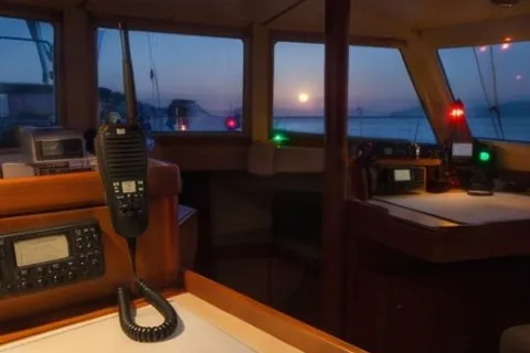
VHF channels to know
| Channel | Use |
|---|---|
| 16 | Distress, urgency, safety and calling. Listen whenever under way. Move to a working channel after first contact. |
| 70 | DSC (digital selective calling) only. Never used for voice. |
| 6 | Ship-to-ship safety and search and rescue on scene. |
| 13 | Bridge-to-bridge navigation safety in many areas. |
| Marina and port | Each port has its own working channel (often 9, 11, 12, 14, 67, 71, 72, 73 or 77 for yachts). Check the marina page or pilot book. |
Distress, urgency and safety calls
MAYDAY (grave and imminent danger to a vessel or person): press and hold the red DSC button if your radio has one, then on channel 16:
"MAYDAY, MAYDAY, MAYDAY. This is [boat name ×3], call sign, MMSI. MAYDAY [boat name]. Position [latitude, longitude or bearing and distance from a known point]. Nature of distress [sinking, fire, man overboard…]. Assistance required. [Number] persons on board. Other information [boat type, colour, life raft, EPIRB]. Over."
PAN-PAN is for urgency without immediate danger to life (engine failure near a lee shore, a medical problem). SÉCURITÉ is for safety information (a drifting container, a navigation warning). The Boat Almanac emergency card prepares the Mayday text with your boat's details.
Phonetic alphabet
Alfa · Bravo · Charlie · Delta · Echo · Foxtrot · Golf · Hotel · India · Juliett · Kilo · Lima · Mike · November · Oscar · Papa · Quebec · Romeo · Sierra · Tango · Uniform · Victor · Whiskey · X-ray · Yankee · Zulu. Numbers are said digit by digit: "one five decimal three".
Sound signals (COLREGs)
| Signal | Meaning |
|---|---|
| 1 short | I am altering my course to starboard (power-driven vessels in sight of each other) |
| 2 short | I am altering my course to port |
| 3 short | I am operating astern propulsion |
| 5 or more short | I do not understand your intentions, or doubt that you are taking enough action |
| 1 prolonged every 2 min | Power-driven vessel making way, restricted visibility |
| 2 prolonged every 2 min | Power-driven vessel under way but stopped, restricted visibility |
| 1 prolonged + 2 short every 2 min | Sailing vessel, vessel not under command, restricted in her ability to manoeuvre, constrained by draught, fishing or towing, in restricted visibility |
| 1 prolonged | Approaching a bend or an area where other vessels may be hidden |
Short blast about 1 second, prolonged blast 4 to 6 seconds.
Navigation lights at a glance
- Sidelights: red to port, green to starboard, each over 112.5° from ahead.
- Sternlight: white, over 135° astern.
- Masthead (steaming) light: white, over 225° forward. Shown by a power-driven vessel, and by a sailing yacht when motoring.
- Sailing: sidelights and sternlight only; under 20 m they may be combined in one tricolour at the masthead (never with the engine on).
- At anchor: one all-round white light where it is best seen (two for vessels of 50 m or more); a black ball by day.
- Restricted visibility or night: lights from sunset to sunrise and whenever visibility is reduced.
Buoyage: IALA region A or B
Lateral marks show the sides of a channel, and the two regions use opposite colours. In region A (Europe, Africa, the Middle East, most of Asia, Australia and New Zealand) red is kept to port when you come in from sea. In region B (North, Central and South America with the Caribbean, Japan, South Korea and the Philippines) red is kept to starboard: "red right returning". Shapes do not change: the can is always the port-hand mark, the cone always the starboard-hand mark.
Red to port when coming in from sea (the opposite of the Americas, Japan, Korea and the Philippines). Preferred channel marks (a lateral mark with a band of the other colour) follow the same colours: the main colour tells you which side to leave the mark on when following the preferred channel.
Red right returning: red to starboard when coming in from sea. Preferred channel marks (a lateral mark with a band of the other colour) follow the same colours: the main colour tells you which side to leave the mark on when following the preferred channel.
Cardinal marks (both regions)
| Mark | Topmarks | Colours | Light (white) | Pass |
|---|---|---|---|---|
| North | both cones point up | black over yellow | continuous quick flashes | north of it |
| East | points apart (base to base) | black, yellow band, black | 3 flashes | east of it |
| South | both cones point down | yellow over black | 6 flashes and one long flash | south of it |
| West | points together | yellow, black band, yellow | 9 flashes | west of it |
Clock face: east is 3 o'clock, south 6, west 9. The topmark cones point to where the black is.
Other marks (both regions)
- Isolated danger: black with red bands, two black balls on top, white light in groups of 2 flashes. A small danger with navigable water all around.
- Safe water: red and white vertical stripes, one red ball on top, white light (isophase, occulting, one long flash, or Morse "A"). Landfall and mid-channel.
- Special mark: yellow, yellow X on top, yellow light. Swimming zones, cables, outfalls, fish farms, racing marks: read the chart.
- Emergency wreck mark: blue and yellow vertical stripes, yellow cross on top, alternating blue and yellow light. A new wreck not yet on the charts; give it a wide berth.
When you cross from one region to the other
Transatlantic and Pacific passages often end in the other region: a boat leaving the Canaries (A) arrives in the Caribbean (B); Hong Kong (A) to Japan (B). Brief the crew before the first landfall, and expect the lights to change colour with the marks. The Boat Almanac route planner warns you when a route changes region.
Summaries for quick reference. The full rules are in COLREGs and the IALA Maritime Buoyage System; national rules can add to them.
Not for navigation. These tools give estimates from simple models; they support good seamanship and do not replace it. Check every result against official charts, tide tables, nautical publications, your instruments and the conditions you see. The skipper is responsible for the boat and the people on board.
More tools
24 calculators and planners
- Signal flags and flag etiquetteThe single-letter flags of the International Code of Signals and where to fly ensign, courtesy flag and Q.
- Crew list for clearing inThe crew list harbour offices, customs and police ask for when you clear in or out: boat details and every person aboard, printed in one tidy page.
- Watch scheduleA fair watch rota for your crew and passage, in the common watch systems.
- World route plannerMarina to marina anywhere on the sea: the route, sailing days, overnight and fuel stops, fuel, water, provisions and packing.
- Provisions plannerHow many people, how many days: shopping list, daily menu and estimated cost, for a single hob and a compact fridge.
- Packing plannerClothing, documents, health and electronics by season and region; tick off and print.
- Where to anchor tonight?Bays near you ranked for tonight's forecast wind, from what sailors reported about their shelter, bottom and holding.
- World voyage plannerA circumnavigation planned season by season: every ocean passage in its window, where to spend each hurricane and cyclone season, distances and time.
- Position and distanceConvert between position formats and get the distance and bearing between two points.
- True, magnetic and compassConvert headings and bearings with variation and deviation, and update variation to this year.
- Course to steer in a currentThe heading that keeps you on track across a tidal stream, your speed over the ground and arrival time.
- Distance off and horizonDistance to the horizon, when a light rises, distance off by vertical angle, doubling the angle and the rule of 60.
- Collision risk (CPA)From two bearings and ranges of another vessel: closest point of approach, when, and its course and speed.
- Tide height (rule of twelfths)Estimate the height of tide at any time between low and high water.
- Sun and moonSunrise, sunset, twilight and the moon phase for any position and date.
- Beaufort scale and sea stateWind force from speed, what the sea looks like, what it means for a yacht and how hard the wind pushes.
- Barometer trendWhat a rise or fall in pressure over three hours tells you, in the words forecasters use.
- True and apparent windWork out the wind you feel on board from the true wind, or the true wind from your instruments.
- Anchoring calculatorScope, how much chain or rode to let out, and the circle your boat will swing in.
- Hull speed and design ratiosHull speed, displacement/length, sail area/displacement, capsize screening and comfort ratio.
- Battery and solar budgetWhat you use in a day, how big the battery bank should be and how much solar covers it.
- Cable size and voltage dropThe cable cross-section a DC circuit needs for its length and current.
- Water and watermakerHow long your fresh water lasts and how long the watermaker must run.
- Unit converterKnots, miles, metres and feet, litres and gallons, bar and psi, kW and hp, °C and °F.